GIS Applications & Uses
How GIS Is Changing the World
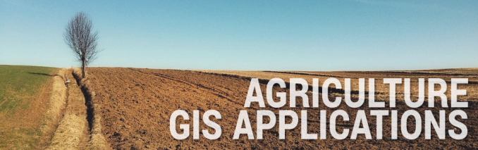
1 Agriculture GIS Applications

In Agriculture the GIS have the Following Application.
1. Precision Farming – Harvesting more bushels per acre while spending less on fertilizer using precision farming and software. (How to win the farm using GIS)
2. Disease Control – Combating the spread of pests through by identifying critical intervention areas and efficient targeting control interventions.
3. Swiss Alps Farming – Cultivating south-facing slopes in the Swiss Alps using aspect data because it shelters from cold and dry winds which is critical to successful crop growth.
4. 3D Scanners for Biomass – Measuring with laser accuracy 3D biomass using the FARO scanner.
5. Real-time Crop Yields – Shifting to real-time crop monitoring and targeted, automated responses with drones and precision watering sensors.
6. Current Food Security – Safeguarding food insecure populations by establishing underlying causes through satellite, mobile-collected and GIS data storage.
7. Agri-tourism – Navigating through crop mazes with GPS receivers in the developing field of agri-tourism.
8. Plant Hardiness – Defining distinct boundaries in which plants are capable of growing as defined by climatic conditions.
9. Machine Performance – Logging geographic coordinates of agricultural machinery in a farm field to better understand the spatially variability cost of field operation and machinery performance.
10. Future Food Demand – Diagnosing the future food demand and planning how to fulfill the needs of a growing and increasingly affluent population.
11. Crop Assimilation Model – Simulating soil, water and crop processes to better understand crop productivity and monitoring using the Crop Assimilation Model tool in GRASS GIS.
12. Water Stress – Balancing the ratio of local withdrawal (demand) over the available water (supply).
13. Historical Agricultural Land – Plotting the historical and future farming trends served.
14. Hunger Map – Raising awareness about global hunger and places that are in need.
15. Agromap – Breaking down primary food crops by sub-national administrative districts and aggregating by crop production, area harvested and crop yields.
16. Crop Resilience to Climate Change – Adapting to climate change and shifting weather patterns by promote the continued health of your fields.
17. Crop Productivity – Calibrating crop productivity using indices like Normalized Difference Vegetation Index (NDVI) to estimate global crop productivity. (Satellite Image Corporation AgroWatch Green Vegetation Index)
18. Erosion-Productivity Impact Calculator (EPIC) – Prioritizing cropland conservation program implementations through “Model Simulation of Soil Loss, Nutrient Loss, and Change in Soil Organic Carbon Associated with Crop Production”.
19. Agriculture Capability – Classifying the varying potential for agricultural production using the Canadian Land Inventory.
20. Ranch Pasture Management – Collecting soils types, fence lines, roads and other data for better management for more meaningful reports and maps.
21. Agricultural Pollution – Quantifying the impacts on climate and the environment from agricultural pollution.
22. Agriculture Revenue – Determining the Effective Opportunity Cost relating to deforestation and potential agricultural revenue with IDRISI GeOSIRIS for REDD.
23. Irrigation – Capturing irrigation infrastructure for land management decisions more than two-thirds of the world’s freshwater withdrawals are for irrigating crops.
24. Farm Preservation – Establishing farm priority zones by analyzing the local farming landscape and constructing criteria for high-quality farming areas.
25. Versatile Soil Moisture Budget – Simulating soil moisture conditions of cropland areas taking into account evapotranspiration, rainfall, runoff and other factors.
26. Drought – Minimizing the impact of drought by analyzing the spatial distribution of rainfall and real-time sensors like SMAP, SMOS and synthetic aperture radar.
27. CropScape – Estimating acreage of crop types and spatial distribution using satellite imagery with National Agricultural Statistics Services. (USDA NASS CropScape)
28. Crop Forecasting – Predicting crop yields using NDVI, weather, soil moisture, soil types and other parameters.
29. Organic Farming – Managing various sources of data for organic farming permits including tillage history, field inputs, crop rotations, and pest management measures on a field-by-field basis.
30. Agricultural Non-Point Source (AGNPS) Model – Predicting the effects of agriculture on water quality using Agricultural Non-Point Source pollution model in MapWindow
31. Drainage Ditches – Tracing farm field drainage lines using stereo imagery in MicroImages TNTMips. (TNT Stereo Viewing Tools)
32. Length of Growing Period – Meeting the full evapotranspiration demands of crops when average temperatures are greater or equal to 5°C and precipitation plus moisture store in the soil exceed half the potential evapotranspiration.